The importance of connectivity - the age of mergers and networks
EnglishNorbert CsizmadiaThe World in 100 MapsThe new catchword: connectivity. What does our world map look like when viewed in terms of connectivity?
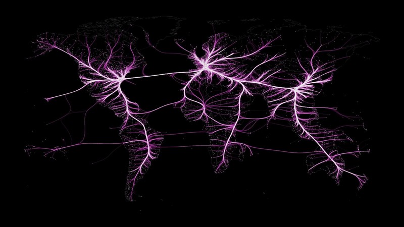
On this unique map, we can see the connectivity map and backbone of our Earth, like never before. The most important branches lead to our most outstanding global cities. The map magnificently outlines our Earth's aerial "backbone network", drawn by David Schoch, a sociologist at the University of Manchester, and geographer Dominic Roye, based on the interconnection of 3,200 airports to more than 60,000 destinations.
The aerial backbone of our earth

Source: Dominic Roye – USC University, David Schoch MCRSociology – 2020
The term geography of connection, i.e., connectography (born of the "connection" of the words connectivity and geography) was introduced and made known by Parag Khanna in his book "Connectography - Mapping of the Future Civilizaton."
Geoeconomic systems are organized into new types of geographical networks, and they operate on the basis of new methodological principles. In this new formation, the direct and indirect interconnection of various infrastructures, even at great distances from each other, and the management and control of the resulting supply chains form the basis of the new geopolitical paradigm.
Interconnection has thus become a new world paradigm, with maps showing the classic borders of countries so far being able to be extended with signals from transmission lines, motorways, rail networks, internet cables, air routes, for example symbols of the global network society.
The geopolitical competition completes and transforms in the struggles for the interconnection of supply systems.
Competitive connectivity is the most important geopolitical factor of the 21st century.
This historic moment may also provide opportunities for countries that do not have landlocked countries to engage in world trade through land and air connections, as the axis of development in the new Eurasian world order shifts from the oceans to the mainland.
Willy Brandt, the former German chancellor, drew a line on the map in the last century. The Brandt line divided the world into 2 spheres, the developed northern and the developing southern countries along the 30 th degree of northern latitude. The countries north of the line were the developed countries and the countries south of the line were developing countries. However, today (thankfully) this is no longer valid.
Yet there is a line on our maps that has always been there, but we didn't apply much importance to it. This is the Eurasian mountain range that stretches from San Sebastian to Chiang Mai in a west-east direction.
In my opinion, the areas north of this, as contiguous areas, are suitable for the interconnection of land infrastructure lines such as transcontinental rail and road networks, pipelines and large land logistics centers, as well as large energy investments.
We can also say that the areas north of the Eurasian mountain system are the so-called "hardware investment" sites, while in the areas south of it, which are much more "fragmented" geographically (with peninsulas) and therefore mainly aviation is the interconnection between them, are the so-called "software investments" and services.
Their main localities are the new global gateway and HUB centers like Hong Kong, Singapore, Dubai, Hyderabad, Geneva, Zurich, Barcelona, etc. which are built on knowledge, technology, financial innovation, creative and cultural industries.
North and south, as respectively hard and soft, can be associated with the geopolitics of "yin-yang" that complement each other and strive for balance.
Today, in an age of complexity, connectivity factors are the most important lines on our maps that are the easiest way to understand our 21 st century world order. However, if we focus only on our infrastructure lines, we can see what we have built, but not how it all affects the rest of the world.
That is why in the 21st century, if we really want to understand what is happening around us, we need to learn three types of geography: natural geography, economic geography and functional geography. Every region counts, as every region is part of the network.
The world is becoming more and more complex, and we need to be aware of the value of interconnectedness, regionalism, and other forces that shape the world far more than our traditional theories of geopolitics, which were based only on territory, size, and military force.
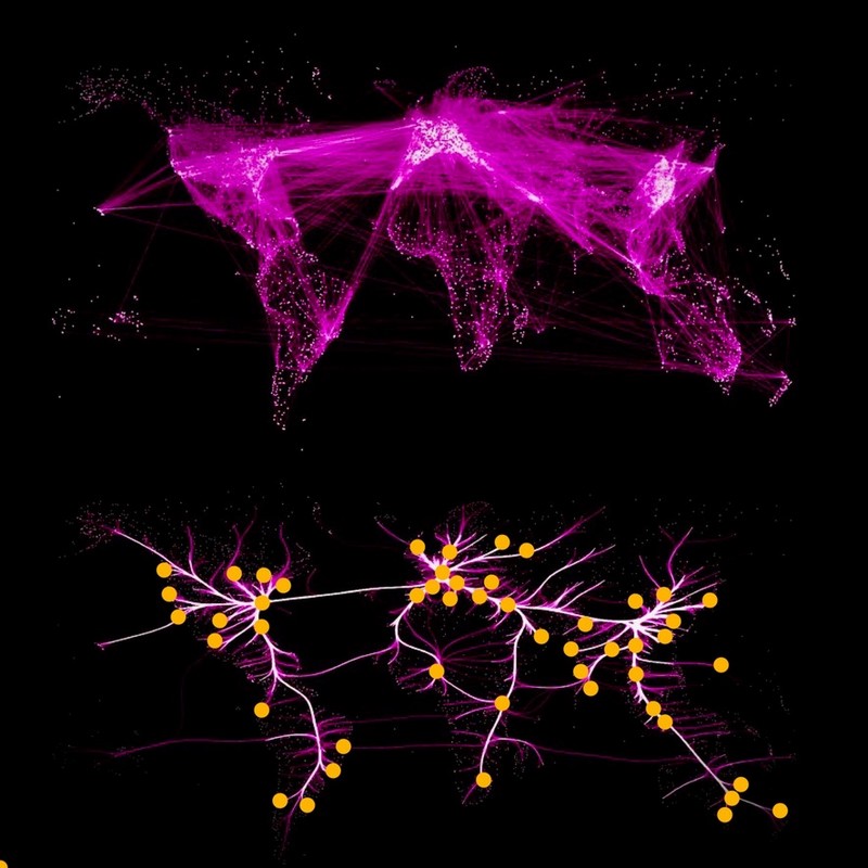
The aerial interconnection of our Earth, the air backbone network,
and the relationship of the location of the 64 global urban center geofusion map

Forrás: saját szerkesztés David Schoch MCRSociology térképe alapján – 2020.
The author is the chairman of the board of trustees of the Pallas Athene Domus Meriti Foundation (PADME).
